Written by Martin King, Noel Keenlyside, Camille Li and Stefan Sobolowski.
The La Niña (cold) phase of the tropical eastern Pacific sea-surface temperature see-saw, known famously as the El Niño-Southern Oscillation (ENSO), appears to be underway and is predicted with high probability to persist until March 2022 (see figure below). More detailed ENSO forecasts are available from the US National Weather Service Climate Prediction Center and the Columbia Climate School International Research Institute for Climate and Society.
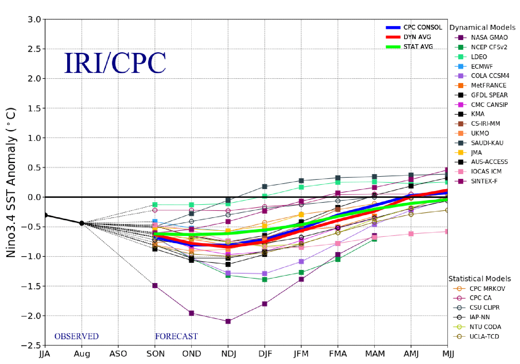
For those of us living in Europe, we might wonder whether or not ENSO influences our seasonal climate, and if so, what the effects might be. Also we might ask if a developing La Niña or El Niño event also affects seasonal climate forecast skill for our region. In 2018, we wrote a research article that explores these questions as well as motivating further research in these directions.
At the time of this post, the seasonal forecasts from November 2021 till March 2022 are available through the EU’s flagship climate prediction and service programme, the Copernicus Climate Change Service (CS3). These forecasts are made by eight climate prediction centres around the world using dynamical models.
In the following figures, we show the predicted November–January and January–March sea-level pressure and two meters surface temperature maps from the multi-model means.
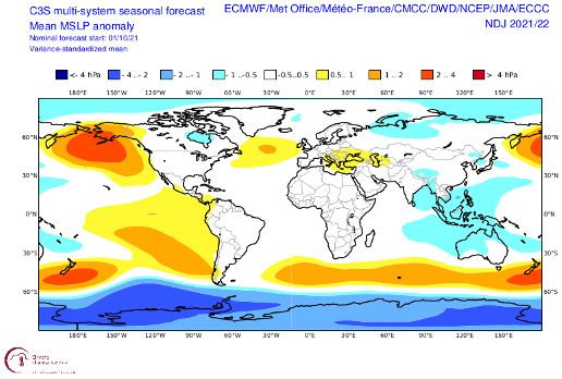
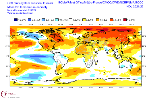
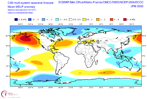
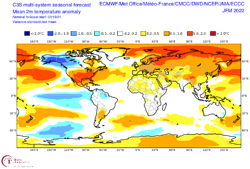
These atmospheric circulation anomalies, resembling the East Atlantic and North Atlantic Oscillation patterns, over the North Atlantic typically bring a colder and drier condition during late autumn-mid-winter (November–January) and a warmer and wetter condition during late winter (January–March).
It must be emphasized that long-term precipitation is notoriously difficult to predict accurately. It also appears that the seasonal forecast for temperatures in northern Europe and Russia are affected by another factor – long-term warming of the Arctic and sub-Arctic ocean. You can explore fields such as precipitation and variation in forecasts among the models here.
The evolution of North Atlantic sea-level pressure patterns shown above are known to be linked to La Niña events. El Niño events are related to nearly the same patterns with opposite signs (King et al, 2018, 2021, Moron and Gouirand, 2003). At least four of the eight C3S models (ECMWF, JMA, Meteo-France, NCEP) forecast this canonical behaviour clearly, and their patterns dominate the multi-model mean maps.
Whether the current forecasts themselves will turn out to be accurate remains to be seen because many physical processes influence weather and climate, but it is interesting to see that some seasonal forecasts have an imprint of ENSO effects in the North Atlantic.
References
King, Herceg-Bulic, Blade, Garcia-Serrano, Keenlyside, Kucharski, Li, Sobolowski, 2018, Importance of fall ENSO teleconnection in the Euro-Atlantic sector, B. Am. Meteorol. Soc. https://doi.org/10.1175/BAMS-D-17-0020.1
King, Li, Sobolowski, 2021, Resampling of ENSO teleconnections: accounting for cold-season evolution reduces uncertainty in the North Atlantic, Weather Clim Dynam. https://doi.org/10.5194/wcd-2-759-2021
Moron, Gouirand, 2003, Seasonal modulation of the El Nino-Southern Oscillation relationship with sea level pressure anomalies over the North Atlantic in October-March 1873-1996, Int. J. Climatol. https://doi.org/10.1002/joc.868

